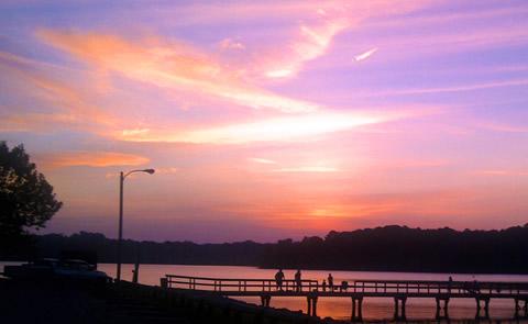
Tennessee-Tombigbee Waterway
Us Army Corps of Engineers, Mississippi.
The Tenn-Tom Waterway is an outdoor enthusiasts' paradise. From picnicking to fishing to camping, the Tenn-Tom has it all. The river section of the waterway stretches from Demopolis, Alabama north to Amory, Mississippi and encompasses 149 miles and four locks and dams. The Canal Section of the Tennessee Tombigbee Waterway stretches North from Amory, Mississippi to Jamie L. Whitten Lock and Dam near Dennis, Mississippi. Forty-six miles in length, it has a total of five locks and dams. The Divide Section of the Tennessee Tombigbee Waterway begins at Jamie L. Whitten Lock and Dam and runs North for 39 miles to Yellow Creek on Pickwick Lake near the Tennessee border.
Camping and Day Use
- Amory Boat Ramp Picnic Shelter
- Blue Bluff Campground (Aberdeen MS)
- Blue Bluff Picnic Area (Aberdeen Lake)
- Cherokee Picnic Shelter
- Dewayne Hayes
- Dewayne Hayes Day Use (Columbus Lake)
- Holcut Picnic Shelter
- Pickensville Cg (Pickensville AL)
- Piney Grove
- Paden Picnic Shelter
- Pickensville Day Use Shelter (Aliceville Lake)
- Piney Grove Beach Picnic Shelter
- Piney Grove Picnic Area Shelters
- Raleigh Ryan Ramp Picnic Shelter (Aliceville Lake)
- Rance Johnson Picnic Shelter
- Stennis East Bank Day Use (Columbus Lake)
- Town Creek Campground - West Point - MS
- Tom Bevill East Bank Day Use (Aliceville Lake)
- Whitten Park
- Waverly Day Use (Columbus Lake)
- West Damsite Picnic Area Shetlers
- Whitten Park Picnic Shelters
Activities and Experiences
Nearby Activities
- Biking
- Boating
- Camping
- Fishing
- Hiking
- Historic & Cultural Site
- Hotel/Lodge/Resort Privately Owned
- Other Recreation Concession Site
- Picnicking
- Playground Park Specialized Sport Site
- Visitor Center
- Water Sports
- Wildlife Viewing
Directions
Additional Information
- Tennessee-Tombigbee Waterway Hunting Map
- Bay Springs Marina
- Columbus Marina
- Marina Cove
- Eastern National
- Tennessee-Tombigbee Waterway Map
- Tennessee-Tombigbee Waterway Website
- Tennessee-Tombigbee Waterway Photo Album
