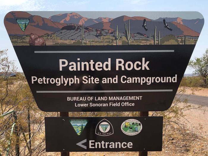
Painted Rock Petroglyph Campground
Lower Sonoran Field Office
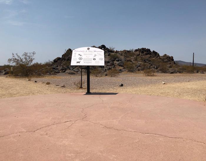
Painted Rock Petroglyph Site, approximately 90 miles southwest of Phoenix, Arizona, provides visitors the opportunity to view an archaeological site containing hundreds of figures and designs carved into rocks, known as petroglyphs. These were produced centuries ago by indigenous peoples. This site is considered important and even sacred to many of the Native American tribes in southern Arizona. Please keep this in mind when you visit and be respectful. Climbing on the rocks is prohibited and we ask that you keep dogs out of the area.There are also inscriptions made by people who passed through during historic times.
Many important trails are near the site, some of which have been traveled for thousands of years. The 1775 expedition of Juan Bautista de Anza passed nearby on his way to deliver soldiers, padres, settlers, and their livestock to a new home in northern California to secure the area for Spain. In 1846, the Mormon Battalion passed through, following Philip St. George Cooke along some segments of this trail to help secure California from Mexico. This venture included road building tasks along the trail, assuring that future trips could accommodate wagons. A need to improve communication and travel from east to west prompted Congress to fund a stage line. The result was the Butterfield Overland Stage Route, which began service in 1858 and traveled by this site. This mail and freight service guaranteed that the mail, freight, or passengers would be able to travel from Saint Louis to San Francisco in 25 days. Use was halted when the railroad was constructed in 1879.
Formerly a unit of the Arizona State Park system, jurisdiction of Painted Rock Petroglyph Site returned to the Bureau of Land Management in 1989.
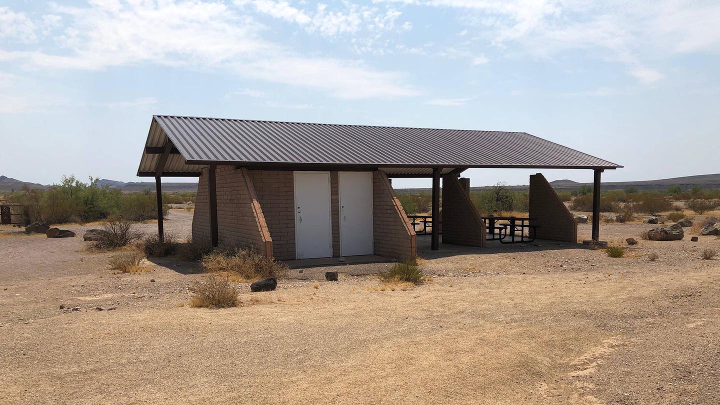
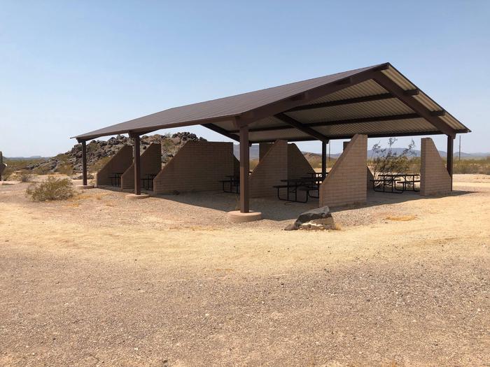
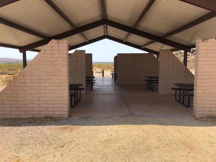
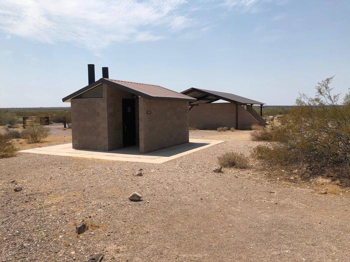
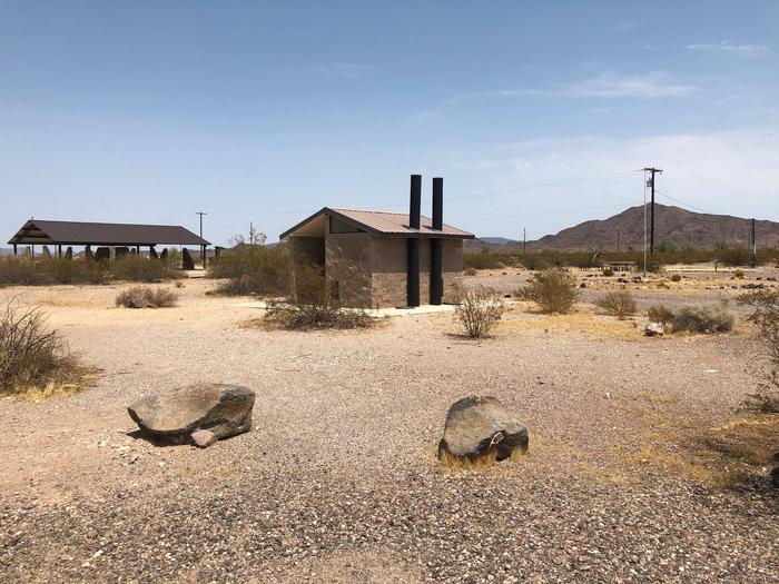
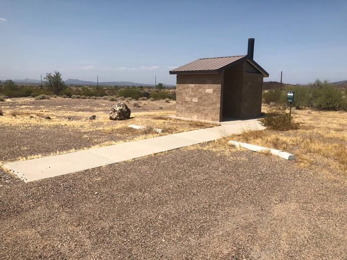
The campground offers visitors 59 individual campsites and two large group sites featuring picnic tables and steel fire rings. There is no water or electric hookups at the campground, but there are two vault toilets and trash collection. The neighboring day-use site has two shaded picnic areas with tables and charcoal grills.
The path to the Painted Rock Petroglyph Campground is on 11 miles of paved roads with an additional 1/2 mile of a dirt road. All roads in the campground and day-use site consist of hardened dirt and gravel suitable for larger RVs (Class A) and trailers (fifth wheels) when road conditions are dry. This area is prone to flash flooding during monsoon season, so be sure to check the weather before planning your visit.
Need to Know
Respect these fragile features by taking only pictures!
Water is not available at this location.
Electrical hook-ups are not available at this location.
There is no dump station at this location.
Please plan accordingly as reliable cell phone service isn’t available at the campground.
There are a number of unique animal/insect species native to this area, so, for your own safety, please do not approach or disturb wildlife.
There is no fire wood available for sale at the campground, please plan accordingly if you intend to have camp fires.
Fire Restrictions may be imposed due to dry conditions, at which time smoking, wood and charcoal fires may be prohibited. Call the Phoenix District Office at (602) 867-5400 to see if any restrictions are in effect.
Natural Features
Set between impressive geologic features such as Oatman Mountain, a few miles to the northwest and the Painted Rock Mountains, situated on the eastern horizon, this campground offers scenic panoramic views and plenty of opportunities for solitude and vast night skies. The surrounding area features a diverse Sonoran Desert plant community including the iconic saguaro cactus, various cholla species, barrel cactus, creosote bush, and both ironwood and palo verde trees. The area is home to a large population of desert mule deer and many other desert species such as kit fox, Gambel’s quail, chuckwalla, and desert iguana.
Nearby Attractions
Woolsey Peak Wilderness
Woolsey Peak Wilderness offers rugged topography, colorful scenic vistas, rich variety of wildlife and vegetation, and outstanding opportunities for solitude and unconfined recreation. Woolsey Peak stands 3,270 feet above sea level and about 2,500 feet above the Gila River (to the south). The Painted Rock Dam flood- control dam is situated on the Gila River not far from the southwestern corner of the area. Encompassing a major portion of the Gila Bend Mountains, it is barely separated from the smaller Signal Mountain Wilderness to the north.
Signal Mountain Wilderness
A narrow, four-wheel-drive road is all that separates Signal Mountain Wilderness from Woolsey Peak Wilderness to the south. Signal Mountain itself, rising just north of the center of the area, reaches a summit of 2,182 feet (1,200 feet above the surrounding desert floor).
Recreation
The day-use site is right next door to the campground and offers two shaded picnic areas and a small interpretive trail around the petroglyph site with informational displays. The petroglyphs face the east-southeast primarily and would have been noticed by any travelers approaching from that direction. Hiking, birdwatching, and star gazing opportunities all present themselves at this site.
Contact Information
Mailing Address
46101 Rocky Point Rd Gila Bend AZ 85337
Physical Address
46101 Rocky Point Rd Gila Bend AZ 85337
Phone Number
For campground inquiries, please call: (602) 867-5400
Rental Options
Learn more about gear rental options for your trip
Driving Directions
Exit Interstate 8 at Painted Rock Dam Road/Exit 102, about 12.5 miles west of Gila Bend. Travel north on Painted Rocks Dam Road 10.7 miles to Rocky Point Road. Painted Rocks Petroglyph Site is 0.6 miles west of Painted Rock Dam Road on Rocky Point Road.
Available Campsites
- Site 56, Loop Patayan Loop, Type Standard Nonelectric
- Site 2, Loop Hohokam Loop, Type Standard Nonelectric
- Site Group Site A, Loop Main Access Road, Type Standard Nonelectric
- Site 34, Loop Patayan Loop, Type Standard Nonelectric
- Site 55, Loop Patayan Loop, Type Standard Nonelectric
- Site 6, Loop Hohokam Loop, Type Standard Nonelectric
- Site 43, Loop Patayan Loop, Type Standard Nonelectric
- Site 58, Loop Patayan Loop, Type Standard Nonelectric
- Site 39, Loop Patayan Loop, Type Standard Nonelectric
- Site 53, Loop Patayan Loop, Type Standard Nonelectric
- Site 42, Loop Patayan Loop, Type Standard Nonelectric
- Site 32, Loop Patayan Loop, Type Standard Nonelectric
- Site 16, Loop Hohokam Loop, Type Standard Nonelectric
- Site 27, Loop Patayan Loop, Type Standard Nonelectric
- Site 11, Loop Hohokam Loop, Type Standard Nonelectric
- Site 21, Loop Hohokam Loop, Type Standard Nonelectric
- Site 30, Loop Patayan Loop, Type Standard Nonelectric
- Site 37, Loop Patayan Loop, Type Standard Nonelectric
- Site 17, Loop Hohokam Loop, Type Standard Nonelectric
- Site 50, Loop Patayan Loop, Type Standard Nonelectric
- Site 52, Loop Patayan Loop, Type Standard Nonelectric
- Site 29, Loop Patayan Loop, Type Standard Nonelectric
- Site 46, Loop Patayan Loop, Type Standard Nonelectric
- Site 12, Loop Hohokam Loop, Type Standard Nonelectric
- Site 1, Loop Hohokam Loop, Type Standard Nonelectric
- Site 48, Loop Patayan Loop, Type Standard Nonelectric
- Site 60, Loop Patayan Loop, Type Standard Nonelectric
- Site 35, Loop Patayan Loop, Type Standard Nonelectric
- Site 13, Loop Hohokam Loop, Type Standard Nonelectric
- Site 4, Loop Hohokam Loop, Type Standard Nonelectric
- Site 49, Loop Patayan Loop, Type Standard Nonelectric
- Site 36, Loop Patayan Loop, Type Standard Nonelectric
- Site 23, Loop Hohokam Loop, Type Standard Nonelectric
- Site 47, Loop Patayan Loop, Type Standard Nonelectric
- Site 26, Loop Patayan Loop, Type Standard Nonelectric
- Site 25, Loop Hohokam Loop, Type Standard Nonelectric
- Site 10, Loop Hohokam Loop, Type Standard Nonelectric
- Site Group Site B, Loop Main Access Road, Type Standard Nonelectric
- Site 59, Loop Patayan Loop, Type Standard Nonelectric
- Site 38, Loop Patayan Loop, Type Standard Nonelectric
- Site 3, Loop Hohokam Loop, Type Standard Nonelectric
- Site 7, Loop Hohokam Loop, Type Standard Nonelectric
- Site 15, Loop Hohokam Loop, Type Standard Nonelectric
- Site 28, Loop Patayan Loop, Type Standard Nonelectric
- Site 9, Loop Hohokam Loop, Type Standard Nonelectric
- Site 40, Loop Patayan Loop, Type Standard Nonelectric
- Site 8, Loop Hohokam Loop, Type Standard Nonelectric
- Site 19, Loop Hohokam Loop, Type Standard Nonelectric
- Site 44, Loop Patayan Loop, Type Standard Nonelectric
- Site 54, Loop Patayan Loop, Type Standard Nonelectric
- Site 33, Loop Patayan Loop, Type Standard Nonelectric
- Site 45, Loop Patayan Loop, Type Standard Nonelectric
- Site 14, Loop Hohokam Loop, Type Standard Nonelectric
- Site 51, Loop Patayan Loop, Type Standard Nonelectric
- Site 5, Loop Hohokam Loop, Type Standard Nonelectric
- Site 31, Loop Patayan Loop, Type Standard Nonelectric
- Site 41, Loop Patayan Loop, Type Standard Nonelectric
- Site 20, Loop Hohokam Loop, Type Standard Nonelectric
- Site 18, Loop Hohokam Loop, Type Standard Nonelectric
- Site 57, Loop Patayan Loop, Type Standard Nonelectric
- Site 22, Loop Hohokam Loop, Type Standard Nonelectric
- Site 24, Loop Hohokam Loop, Type Standard Nonelectric
Photo Gallery