1
Campground
Campground Calendar
mm
/
dd
/
yyyy
mm
/
dd
/
yyyy
May | |||||||||||
|---|---|---|---|---|---|---|---|---|---|---|---|
Availability Table Bottom Menu
No Campsites Selected
Content is loading
May | |||||||||||
|---|---|---|---|---|---|---|---|---|---|---|---|
No Campsites Selected
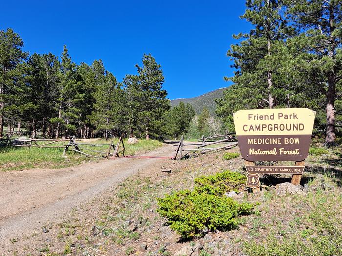
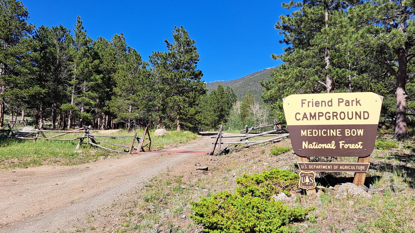
Medicine Bow-Routt Nfs & Thunder Basin Ng
Situated at the base of Laramie Peak, the Friend Park Campground has 11 sites surrounded by firs, pines, and aspens with beautiful Friend Park to the southwest. A favorite of both tent and trailer campers, it is another great location for recreating within the Laramie Peak Unit of the Douglas Ranger District. The campground is popular for OHV riding, fishing, hiking, hunting, mountain biking, or just getting away to relax.
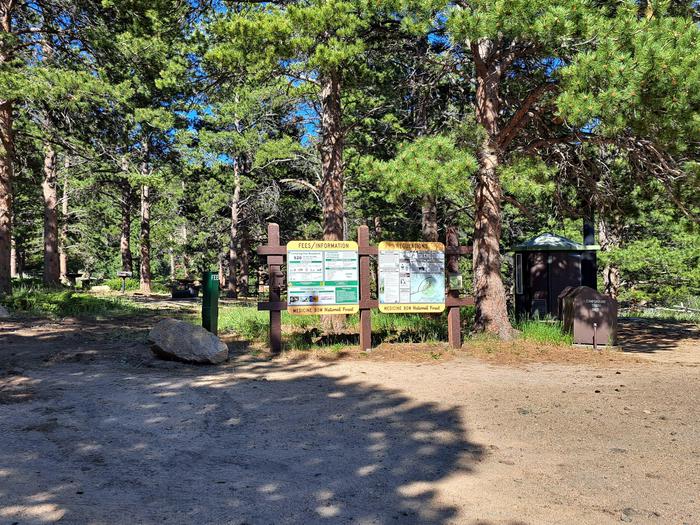
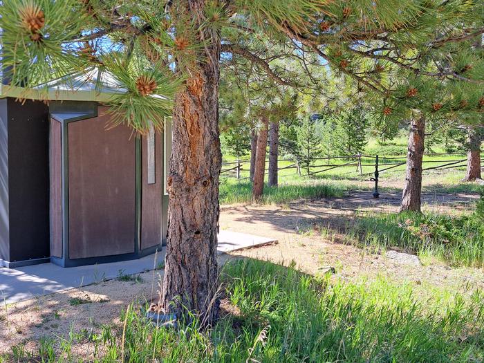
There are 11 campsites in a lightly wooded, rocky area with picnic tables, fire rings, pedestal grills, vault toilets, trash collection, and potable water. Most campsites have abundant shade and several of the walk-in sites are spaced far enough apart to have a dispersed feel.
Potable water is typically available in this campground from early June to late November. These dates may vary due to weather. Potable water availability may vary due to well and/or pump maintenance, and water testing requirements. As such, we encourage you to bring your own drinking water or call ahead.
Need to Know
**The road construction on FSRD 671 Bear Creek is almost complete, and it is almost like new.
Check-in time is after 2:00 p.m. on the first day of the reservation.
Check-out time is 1:00 p.m. on the last day of the reservation.
If the reservation holder doesn't show up on the first day of the reservation, the campsite is released at check-in time (2 pm) the next day.
There are no hookup services.
Maximum length of stay is 14 days.
Fires are only allowed in USFS approved metal fire rings.
Single Campsites are limited to 8 people and 2 vehicles per site, Double sites are 16 people and 4 vehicles.
Only 1 RV/trailer per single campsite.
No vehicles or trailers can park in parking spaces for walk-in tent campsites. These campsites and associated parking are for tent camping only.
Dogs must be on a leash within the campground.
Quiet hours are 10:00 p.m. to 8:00 a.m.
You are responsible for reading the site descriptions and booking a site that will accommodate your equipment.
Check the elements
-What is in the skies? Check the weather report before you leave home. When you arrive at the site, keep on eye on the skies for changes and, if possible, carry a compact weather radio. In inclement weather, take shelter until the bad weather passes. Stay dry - wet clothes contribute to heat loss. Also, keep sleeping bags and important gear dry at all times.
-Are there forest or grassland alerts? Forest and grassland home pages post alerts you should know before you go. Many of our forests and grasslands also post alerts on Twitter. The latest fire information may be found on InciWeb.
Survey your surroundings
-Arrive early. Plan your trip so that you arrive at your actual campsite with enough daylight to check over the entire site and safely set up camp.
-Check for potential hazards. Be sure to check the site thoroughly for glass, sharp objects, branches, large ant beds, poison ivy, bees, and hazardous terrain.
-Avoid areas of natural hazards. Check the contour of the land and look for potential trouble spots due to rain or snow. Areas that could flood or become extremely muddy can pose a problem.
-Inspect the site. Look for a level site with enough room to spread out all your gear. A site that has trees or shrubs on the side of prevailing winds will help block strong, unexpected gusts.
-Pitch your tent in a safe spot. Make sure your tent is made of flame-retardant fabric, and keep it a safe distance away from campfires. Keep insects out of your tent by closing the entrance quickly when entering or leaving.
Be fire safe
- Check to know whether there are fire restrictions in place before starting a campfire. You could be fined if you start a fire in a restricted area.
-Keep fires small and bring firewood purchased in the local area. Firewood brought from another area could also bring invasive pests.
-If you have to collect firewood at your campsite, collect dead and down wood only.
-Use existing fire rings. Scrape away litter and any other burnable material within a 10-foot-diameter surrounding the ring.
-Make sure all wood fits inside the fire ring. Do not feed a large log into the fire ring.
-Have a shovel, axe, and bucket of water available before lighting your campfire.
-Never leave a campfire unattended, even for a few minutes or even if there are no flames present. Many wildfires start because of abandoned fires or because someone thought a fire was out.
-Put out a campfire by slowly pouring water onto the fire and stirring with a shovel. Continue adding and stirring until all material is cool to touch.
-Do not bury your fire. The coals can smolder and re-ignite.
Be bear aware
Being outdoors means being with wildlife. Many people never encounter a bear. But if you do, here's some simple advice:
DO NOT RUN.
*Remain calm.
*Group together and pick up small children.
*Continue to face the bear and back away slowly, talking calmly to identify yourself as a human.
*If the bear continues to approach, try to scare it away by making yourself as large and imposing as possible by stretching your arms overhead and making loud noises.
*Carry and know how to use bear spray, which is available at many outdoor retailers and can be used to deter a charging bear.
Food Storage
Bears are always searching for food. Bears are curious, intelligent animals that have great memories. Their eyesight is similar to humans and their sense of smell is seven times more powerful than a blood hound’s, enabling them to smell food from miles away. Those are the very traits that can sometimes get them – and us – into trouble. Most bears are wary of humans and try to avoid them. However, bears can learn to associate people with food and be tenacious in their pursuit of something to eat. Even if humans are around.
Everyone in bear country must do our part to store food and other attractants in bear-resistant containers at all times, and dispose of trash in bear-resistant dumpsters.
The campground is at an elevation of 7,572 feet within a mature stand of ponderosa pine, along with aspen and firs. Several of the walk-in sites have a great view of Laramie Peak. The general area is intermixed with timber, meadows and large rock formations.
The highest peak in the Laramie Range at 10,200 feet, Laramie Peak was once a welcome sign to pioneers on the Oregon and Mormon trails, as well as the first ‘real' mountain most had ever seen.
Visitors can find many outdoor opportunities in the surrounding area including OHV riding, hiking, backpacking, mountain biking, hunting, fishing, sightseeing, rock climbing, photography, and horseback riding. Fishing opportunities nearby in Friend Creek and Upper Horseshoe Creek. Sunday services available nearby at the historic Esterbrook Community Church (non-denominational).
The Laramie Peak area in the Medicine Bow National Forest is located in Central Wyoming. The Douglas Ranger District manages the Laramie Peak and Thunder basin National Grasslands areas. Year-round recreation uses include hiking, fishing, hunting, OHV riding, camping, biking, horseback trail riding, and rock climbing. Primary access across the district is by I-25 and Highway 59.
The Laramie Peak Connector Trail leaves the campground and leads to the Friend Park Trail and Laramie Peak Trail. Hiking access to the Roaring Fork Trail is located along the nearby FSRD 661.A.
There are many fishing opportunities just below the campground in Friend Creek and the beaver ponds along the Connector Trial. Other fishing areas are along the Upper Horseshoe Creek on National Forest System lands and WY State Trust land.
Mountain Biking
• Upper Roaring Fork Trail
• Friend Park Trail
• North Laramie River Trail
• Harris Park Trail
• Laramie Peak Trail
• Sunset Ridge Trail
• Lost Creek Trail
• Arapaho Trail
• Albany Peak Trails
• Black Mountain Look out
Mountain Climbing
• Curtis Gulch Trail
• Upper Roaring Fork Trai
Day Hiking
• Upper Roaring Fork Trail
• Friend Park Trail
• North Laramie River Trail
• Harris Park Trail
• Laramie Peak Trail
• Sunset Ridge Trail
• Lost Creek Trail
• Albany Peak Trails
• Black Mountain Look out
Backpacking
• Upper Roaring Fork Trail
• North Laramie River Trail
• Harris Park Trail
• Lost Creek Trail
• Albany Peak Trails
Horseback riding
• Upper Roaring Fork Trail
• Friend Park Trail
• Arapaho Trail
• North Laramie River Trail
• Harris Park Trail
• Laramie Peak Trail
• Sunset Ridge Trail
• Lost Creek Trail
• Black Mountain Look out
OHV Riding
• Arapaho Trail
• FSRD633 Trails
• Sunset Ridge Trail
• North Laramie River Trail
• Laramie Peak Trail
• Albany Peak trails
• Black Mountain Look out
For campground inquiries, please call: N/A
Learn more about gear rental options for your trip
DIRECTIONS:
Campground is approximately 47 miles South of Douglas, WY. Take Hwy 94 (Esterbrook Road) south from Douglas for 17 miles. Continue south on CR 5 for 11 miles, then southwest 15 miles on CR5, turn left (SE) on FSRD 671 for 2 miles to FSRD 661 then 1 mile to the campground.
From Rock River (59 miles) Take Hwy 287 North, turn right onto Fetterman Road (CR 61) travel 33.6 miles (gravel road after 10.5 mile), turn Right on CR74 Garrett Rd, in 6.7 miles this will turn into CR77 Bear Creek Rd, then FSRD 671, after 14 miles turn right onto FSRD 661, Friend Park Road for 1 mile to the CG.
Recreation.gov is your gateway to explore America's outdoor and cultural destinations in your zip code and across the country. We provide tools and tips to discover new adventures through a one-stop shop for inspiration and ideation, trip planning, information sharing, and reservations. Find incredible places and experiences that help you bring home a story through Recreation.gov!