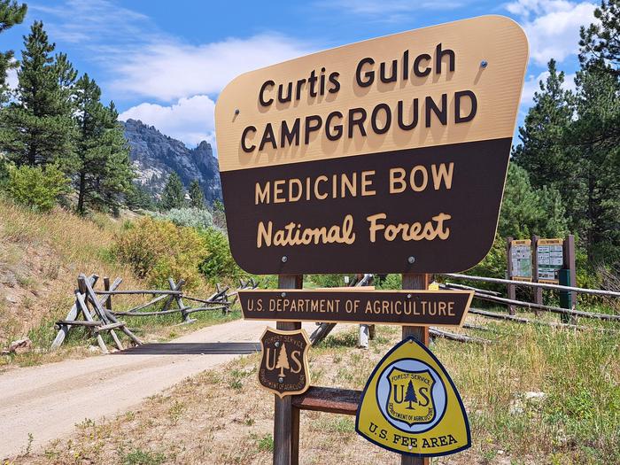
Curtis Gulch Campground
Medicine Bow-Routt Nfs & Thunder Basin Ng
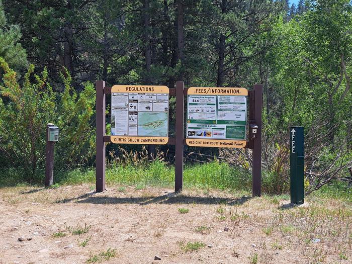
Curtis Gulch Campground sits at an elevation of 6,640 feet deep inside the long and scenic LaBonte Canyon. There are 6 sites with picnic tables, fire rings, pedestal grills, a vault toilet, pump water well, and trash bins.
There are 6 sites tucked into a bend of the LaBonte Creek with picnic tables, fire rings, pedestal grills, a vault toilet, pump water well, and trash bins.
Need to Know
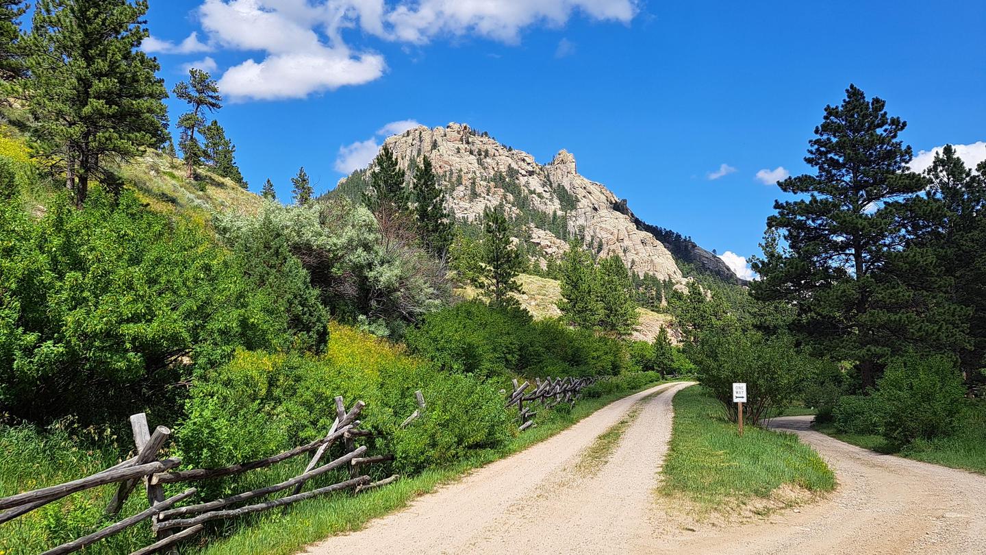
** The gravel roads leading to Curtis Gulch CG can be muddy and slippery after a significant rain event, but they dry out in about a day. The CG is accessible by car when the roads are dry.
Check-in time is after 2:00 p.m. on the first day of the reservation.
Check-out time is 1:00 p.m. on the last day of the reservation.
If the reservation holder doesn't show up on the first day of the reservation, the campsite is released at check-in time (2 pm) the next day.
There are no hookup services.
Maximum length of stay is 14 days.
Fires are only allowed in USFS approved metal fire rings.
Single Campsites are limited to 8 people and 2 vehicles per site.
Only 1 RV/trailer per single campsite.
Dogs must be on leash within the campground.
Quiet hours are 10:00 p.m. to 8:00 a.m.
You are responsible for reading the site descriptions and booking a site that will accommodate your equipment.
Check the elements
-What is in the skies? Check the weather report before you leave home. The roads leading into the campground generally require a 4 wheel drive vehicle following a moderate or heavy rain event. They dry quickly and are most often passable by car again within a few days.
-When you arrive at the site, keep an eye on the skies for changes and, if possible, carry a compact weather radio. In inclement weather, take shelter until the bad weather passes. Stay dry - wet clothes contribute to heat loss. Also, keep sleeping bags and important gear dry at all times.
-Are there forest or grassland alerts? Forest and grassland home pages post alerts you should know before you go. Many of our forests and grasslands also post alerts on Twitter. The latest fire information may be found on InciWeb.
Survey your surroundings
-Arrive early. Plan your trip so that you arrive at your actual campsite with enough daylight to check over the entire site and safely set up camp.
-Check for potential hazards. Be sure to check the site thoroughly for glass, sharp objects, branches, large ant beds, poison ivy, bees, and hazardous terrain.
-Avoid areas of natural hazards. Check the contour of the land and look for potential trouble spots due to rain or snow. Areas that could flood or become extremely muddy can pose a problem.
-Inspect the site. Look for a level site with enough room to spread out all your gear. A site that has trees or shrubs on the side of prevailing winds will help block strong, unexpected gusts.
-Pitch your tent in a safe spot. Make sure your tent is made of flame-retardant fabric, and keep it a safe distance away from campfires. Keep insects out of your tent by closing the entrance quickly when entering or leaving.
Be fire safe
- Check to know whether there are fire restrictions in place before starting a campfire. You could be fined if you start a fire in a restricted area.
-Keep fires small and bring firewood purchased in the local area. Firewood brought from another area could also bring invasive pests.
-If you have to collect firewood at your campsite, collect dead and down wood only.
-Use existing fire rings. Scrape away litter and any other burnable material within a 10-foot-diameter surrounding the ring.
-Make sure all wood fits inside the fire ring. Do not feed a large log into the fire ring.
-Have a shovel, axe, and bucket of water available before lighting your campfire.
-Never leave a campfire unattended, even for a few minutes or even if there are no flames present. Many wildfires start because of abandoned fires or because someone thought a fire was out.
-Put out a campfire by slowly pouring water onto the fire and stirring with a shovel. Continue adding and stirring until all material is cool to touch.
-Do not bury your fire. The coals can smolder and re-ignite.
Be bear aware
Being outdoors means being with wildlife. Many people never encounter a bear. But if you do, here's some simple advice:
DO NOT RUN.
*Remain calm.
*Group together and pick up small children.
*Continue to face the bear and back away slowly, talking calmly to identify yourself as a human.
*If the bear continues to approach, try to scare it away by making yourself as large and imposing as possible by stretching your arms overhead and making loud noises.
*Carry and know how to use bear spray, which is available at many outdoor retailers and can be used to deter a charging bear.
Food Storage
Bears are always searching for food. Bears are curious, intelligent animals that have great memories. Their eyesight is similar to humans and their sense of smell is seven times more powerful than a blood hound’s, enabling them to smell food from miles away. Those are the very traits that can sometimes get them – and us – into trouble. Most bears are wary of humans and try to avoid them. However, bears can learn to associate people with food and be tenacious in their pursuit of something to eat. Even if humans are around.
Everyone in bear country must do our part to store food and other attractants in bear-resistant containers at all times, and dispose of trash in bear-resistant dumpsters.
Natural Features
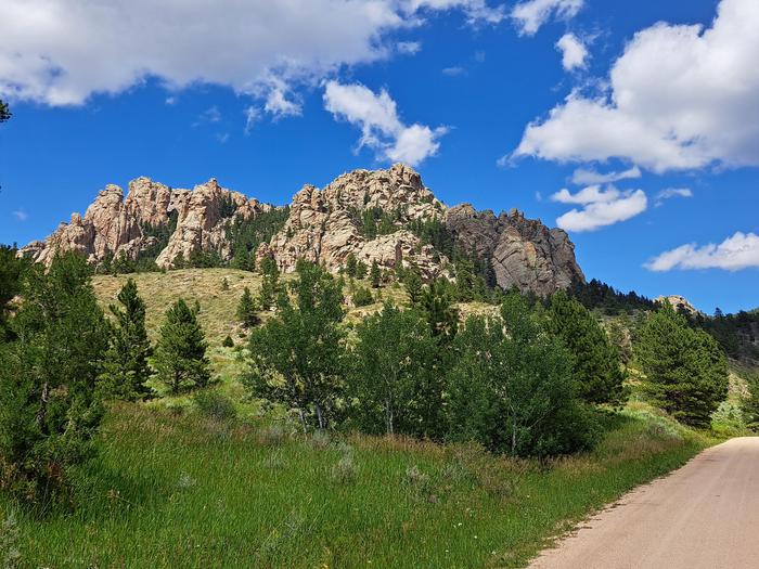
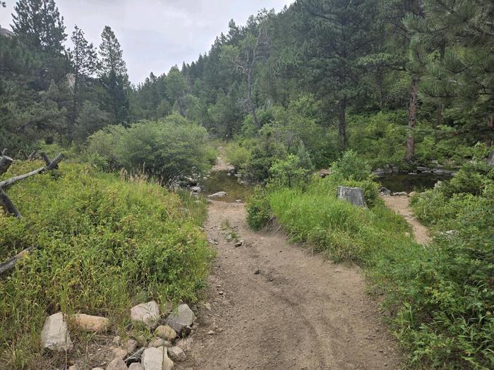
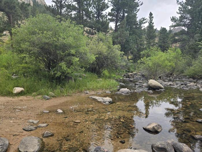
The Curtis Gulch Campground is located at the end of FSRD 658 in LaBonte Canyon. The natural beauty of the steep canyon sides, LaBonte Creek running the length of the entire canyon, and patches of aspen within the mature conifer forest, makes this area one of the most popular and frequently visited on the district.
Nearby Attractions
LaBonte Creek and Toltec Reservoir offer anglers many fishing opportunities. Brumley FSRD 690, Devil's Pass FSRD 610, and the FSTR 635 S Fork LaBonte trails offer OHV riders additional areas to explore.
Recreation
Recreation
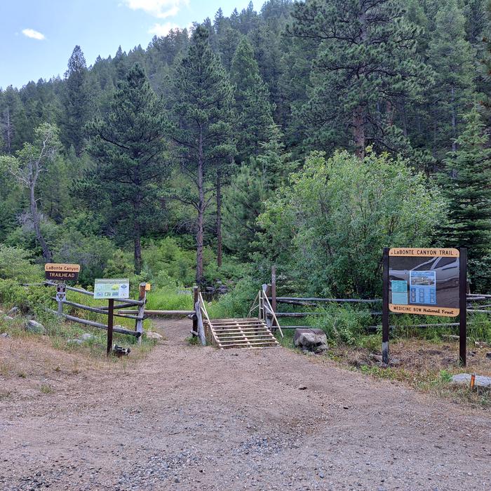
The canyon bottom is about 6,700 feet in elevation and has granite rock formations for technical rock climbing and photography. LaBonte Creek runs through the entire length of the canyon and offers anglers many opportunities to catch the rainbow trout stocked annually by the WGFD. For OHV riding, the LaBonte Canyon Trail starts at the back of the campground, and The Big Bear Trail System is located just 1/4 mile up the canyon. Both are 50” or less OHV trails but are also commonly used for hiking, biking, and horseback riding. FSRD #610, Devil's Pass, and the South Fork LaBonte Trails to the south offer additional opportunities for adventure. The Curtis Gulch Trail is non-motorized and starts at the trail parking area just outside the campground.
The Laramie Peak Unit of the Medicine Bow National Forest is located in Central Wyoming. The Douglas Ranger District manages the Laramie Peak and Thunder Basin National Grasslands. Year-round recreation uses include hiking, fishing, hunting, climbing, OHV riding, dirt bike riding, camping, biking, and horseback trail riding. Primary access across the district is by I-25 and Highway 59.
Mountain Biking
• Curtis Gulch Trail
• Labonte Canyon Trail
• Big Bear Canyon Trails
Rock Climbing
• Curtis Gulch Trail
Day Hiking
• Curtis Gulch Trail
• Labonte Canyon Trail
• Big Bear Canyon Trails
Backpacking
• Curtis Gulch Trail
• Big Bear Canyon Trails
• Labonte Canyon Trail
Horseback riding
• Curtis Gulch Trail
• Labonte Canyon Trail
• Big Bear Canyon Trails
OHV Riding
•Labonte Canyon Trail
• Devils Pass/South Fork Labonte Trails
• Big Bear Canyon Trails
Changes & Cancellations
If I book this reservation today, what are my options to change or cancel?
Please remember that reservations at these facilities prevent other visitors from using these sites. Planned changes to your stay should be made as far in advance as possible. You can make changes to your reservation ahead of your arrival date in My Reservations.
Changes
If your new stay dates are completely different from your original stay dates, there is a $10 change fee (per reserved site). There are no additional fees for:
Adding or removing nights to your stay.
Changing to a different campsite.
Balances will adjust based on your new stay's nightly rate.
Cancellations
You can cancel the reservation any time before the date of your scheduled arrival. You will receive a refund for your stay, minus the following fees:
$10 cancellation fee
Any reservation fees (only if paid when booking)
Any previous change fees
Late cancellation penalties may also apply:
What is “Late”?
For individual campsites, a late cancellation applies starting from midnight 1 calendar day before your scheduled check-in. For cabins and group sites, a late cancellation applies starting from midnight 14 calendar days or fewer before your scheduled check-in.
Late Fee
In addition to the fees listed above, a late cancellation will also subtract your first night's recreation use fee from any refund owed. As of the expected check-in day, cancellations or changes to your stay are not possible through My Reservations. It is at the facility's discretion to support additional Late Cancellations, No Show, or Early Departure updates – on-site personnel may not be able to assist. These changes carry penalties and may forfeit recreation use fees. For additional details, please visit here.
Scan and Pay Rules
The above guidance for modifications, cancellations, and refunds do not apply to campsites reserved using the Scan and Pay feature. There are no refunds, modifications, cancellations, or other fee changes allowed with Scan and Pay payments. This system is the same as putting cash into a fee tube and cannot be refunded.
Contact Information
Mailing
2250 East Richards ST Douglas WY 82633
Phone Number
For campground inquiries, please call: 307-358-4690
Rental Options
Learn more about gear rental options for your trip
Driving Directions
From Douglas WY (30 miles), Take State Highway 91 west then south from Douglas for 22 miles, Converse County Road 16
continuing as Albany County Road 61 south for 14 miles, and east on Forest Road #658 for 4 miles.
The pavement ends about 25 miles outside of Douglas and is gravel the remainder of the way, but is easily accessible by car when dry.
Available Campsites
- Site 5, Loop Main, Type Standard Nonelectric
- Site 2, Loop Main, Type Standard Nonelectric
- Site 6, Loop Main, Type Standard Nonelectric
- Site 4, Loop Main, Type Standard Nonelectric
- Site 1, Loop Main, Type Standard Nonelectric
- Site 3, Loop Main, Type Standard Nonelectric
Photo Gallery