1
Campground
Campground Calendar
mm
/
dd
/
yyyy
mm
/
dd
/
yyyy
July | |||||||||||
|---|---|---|---|---|---|---|---|---|---|---|---|
Availability Table Bottom Menu
No Campsites Selected
Content is loading
July | |||||||||||
|---|---|---|---|---|---|---|---|---|---|---|---|
No Campsites Selected
Nez Perce-Clearwater National Forests
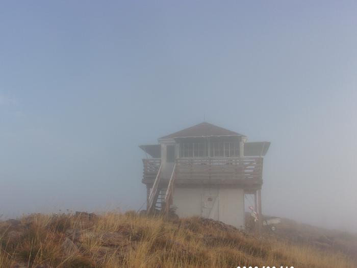
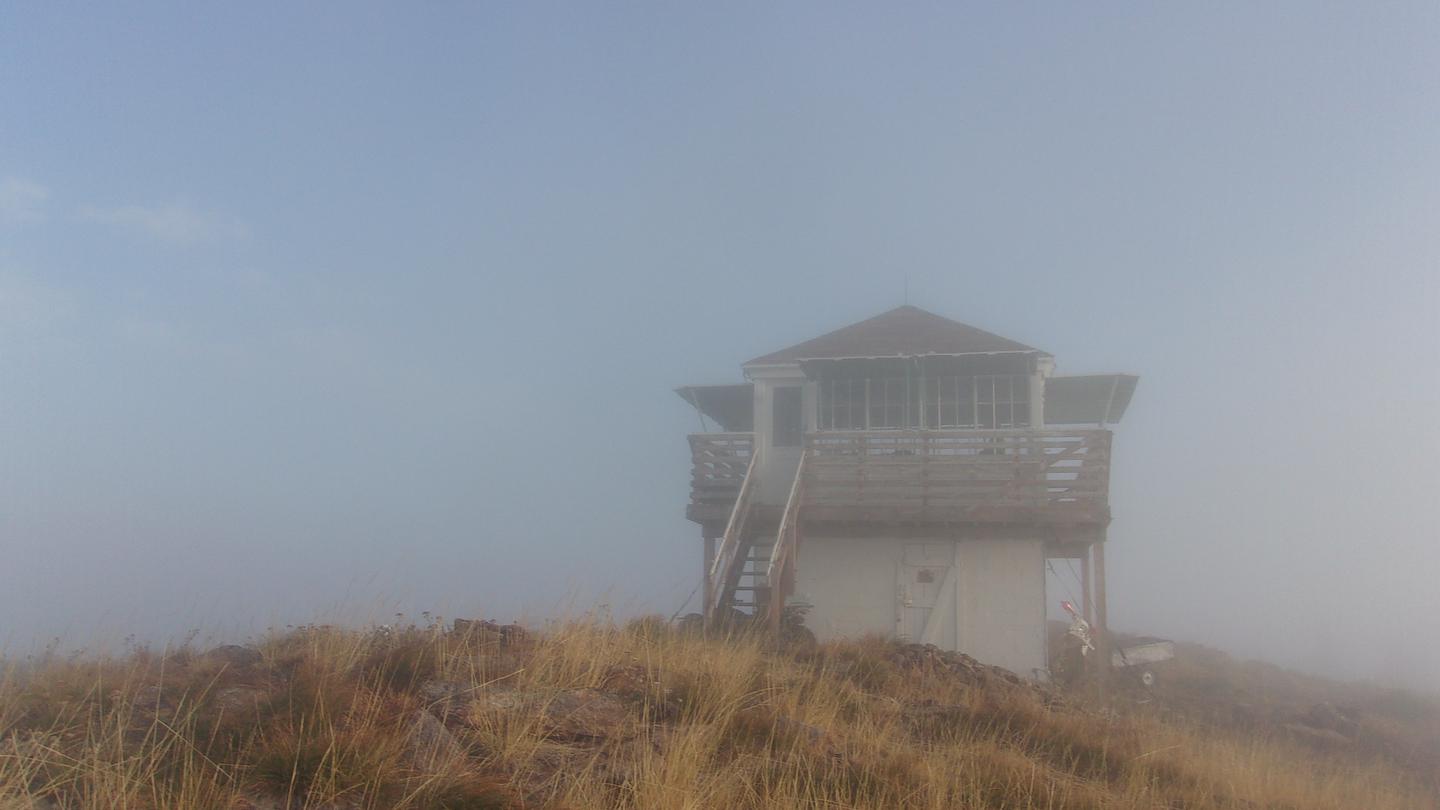
The popular lookout is perched on Scurvy peak at the end of trail #524 overlooking the Moose buttes, Cayuse and Kelly Cr drainages and Scurvy Lake. The first lookout was a platform built in 1917 with a cabin added in 1935. The present cab was built in 1952 that was gradually restored by volunteers over a 10-year span and became an inclusion to the National Register of Historic lookouts in 2004. The trailhead to the cabin is not assessable with low clearance vehicles, and the 4 plus miles of trail from the trailhead to the cabin is a moderately difficult, multi-use trail with several steep grades. Guests must bring their own supplies and gear for a comfortable stay as there are no linens, cleaning supplies, or toiletries provided. Although assessable by OHV's less than 50" in width, the roads and trails leading to the cabin can be partially or fully blocked by debris or snowpack in the early season. Off trail/road motorized travel is strictly prohibited. Visitors are strongly advised to consult the forest website, as well as a map prior to reserving or traveling to the cabin and to call the district information desk with any questions.
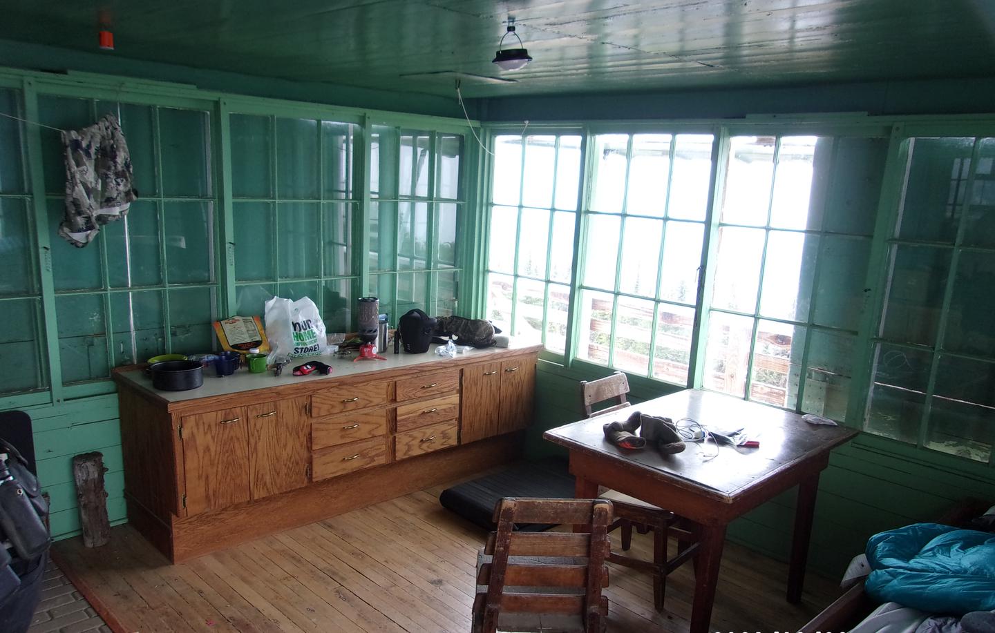
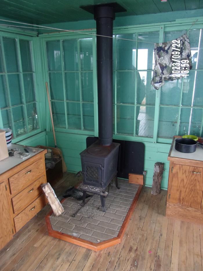
The restored lookout is comprised of a 12’ x 12’ wooden “cab” surrounded by a catwalk on a 8’ high cinderblock structure. One bed, a small table with a couple chairs, two countertops that contain cabinets, a small modern wood stove, and a pit toilet outhouse are the only amenities provided. The closest water source is a small spring approximately 1/2 mile from the lookout on trail 524 (about 100 yards towards the lookout from the 524/531 trail junction 25 yards off trail 524 on the downhill side) that requires treatment before consumption.
Guests are required to pick up after their pets/stock, pack out their trash, and clean the cabin before they check-out with the provided broom under the “Leave it Cleaner than when you arrived” and the “Pack it in Pack it out” policies so everyone may enjoy their stay.
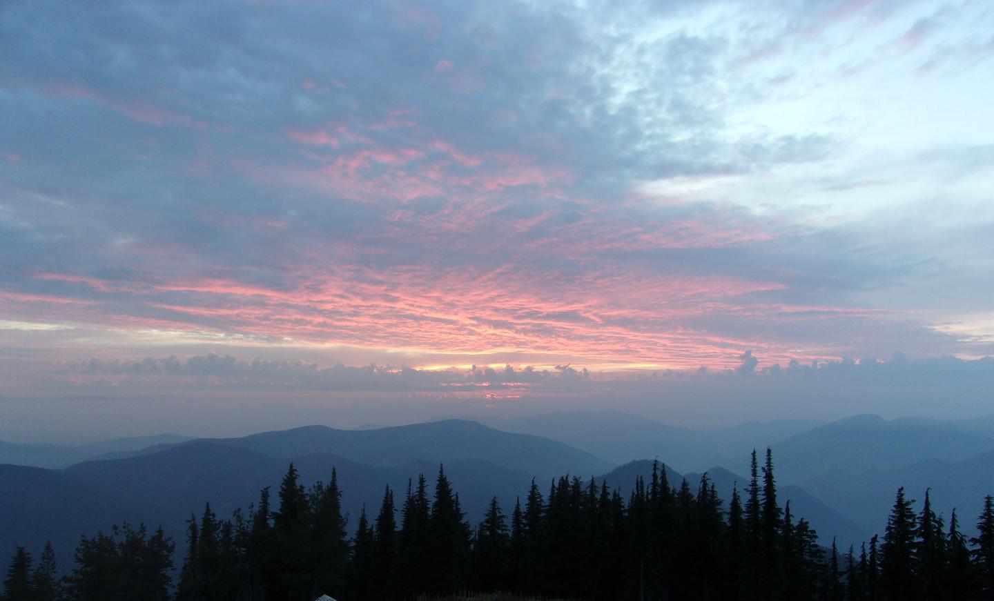
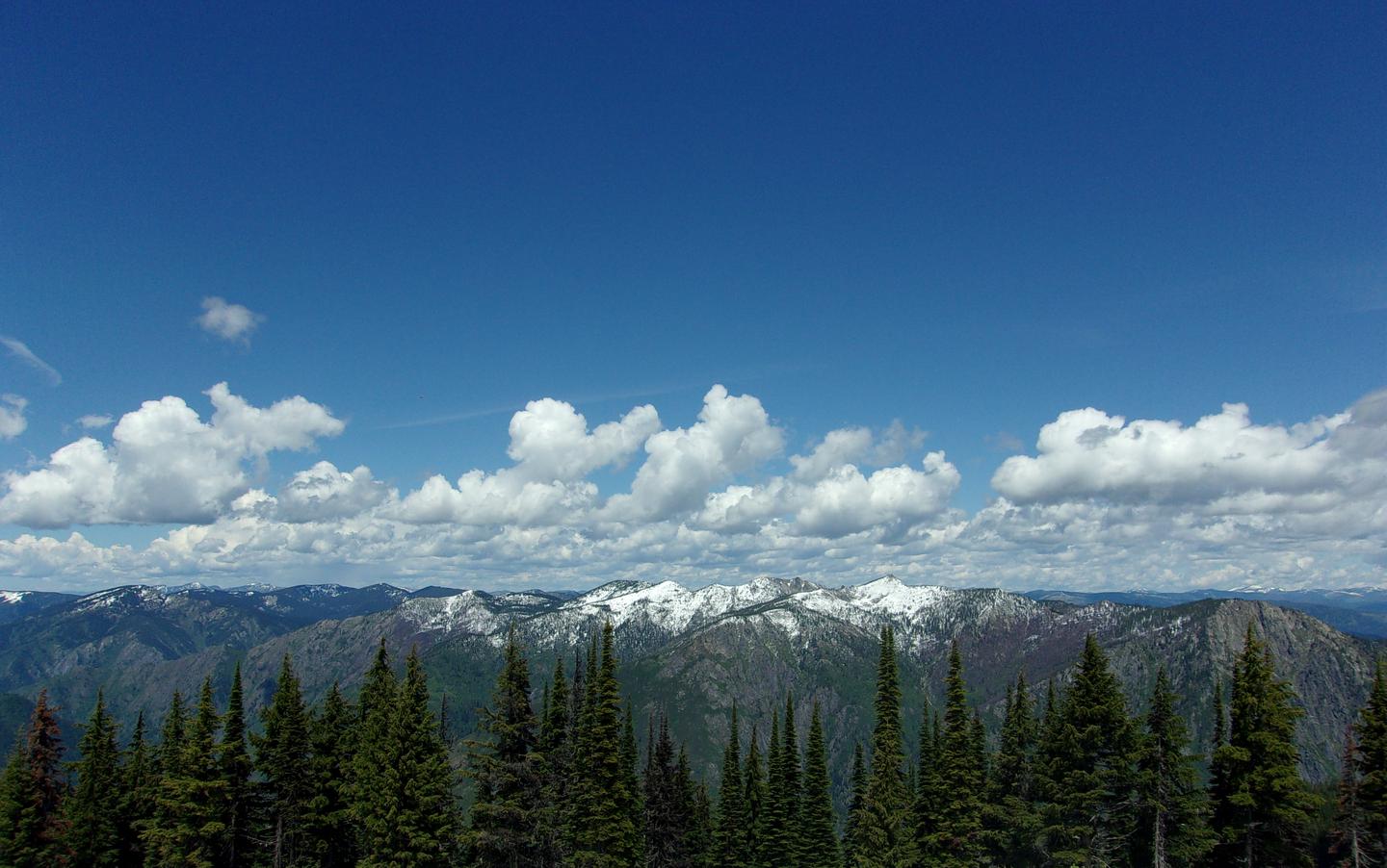
The low profile 10’ high lookout cab is positioned in a clearing on top of Scurvy mountain’s 6600’ peak. The vantage point provides guests with a panoramic view of the surrounding area that include the Cayuse Cr and Weitas Cr drainages to the South, Cook Mountain in the west, a broadside of the Moose Cr Buttes to the north, the Bitterroot Mountains, and Scurvy Lake to the east. The area boasts a wide diversity of wildlife and birds, so visitors never know what to expect while enjoying the scenery, but mule deer, mountain lion, black bear, elk, Mountain Bluebird, Mountain Jay, Raven, and Tanager are the most common. The unhindered view of the sunsets and rises on the horizon can be quite spectacular, as is the stargazing on a clear evening or the extraordinary fall colors back dropped with mountains capped by advancing snow late in the season are sites to behold.
The North Fork Ranger District prides itself on the diversity of world class recreational opportunities ranging from bird/wildlife watching, big game hunting, whitewater rafting, leisurely floats, secluded backpacking/equestrian trails into the high mountain backcountry, to motorized OHV trail systems providing unique experiences that draw visitors from around the world and all walks of life.
Due to its location, the lookout is an ideal base camp for those looking to reconnect with nature, or as a stopover for a variety of outdoor enthusiasts as they explore the district. The remote location combined with the open skyline and a 360-degree view is perfect for those who enjoy stargazing. There are also several other trails in the vicinity that offer connection to a host of recreation opportunities including berry picking, hiking, biking, sightseeing, and birding being the most popular. Recreate responsibly, be sure to check the regulations and rules to educate yourself before you recreate by visiting https://idfg.idaho.gov/ and https://www.fs.usda.gov/news/nezperceclearwater/news-events for up-to-date information.
For campground inquiries, please call: 208 (476) 4541
Learn more about gear rental options for your trip
Scurvy Mountain Lookout is approximately 35 air miles northeast of the community of Pierce, Idaho on the North Fork Ranger District of the Nez Perce-Clearwater National Forest.
The last 50 miles of travel to the cabin from Pierce are mostly single lane, gravel surfaced roadways that may be peppered with large potholes and rocks, the last 4 miles being rutted 2 track road requiring 4X4 high clearance vehicles operated by experienced operators and 5 miles of multi-use, moderate difficulty trail. Seasonal conditions permitting, the cabin is also approachable from I90 via Superior MT, with the addition of a high mountain pass that is usually impassible from late Oct to mid-July with 50 miles of gravel/dirt road conditions including 4 miles being rutted 2 track road requiring 4X4 high clearance vehicles operated by experienced operators and 5 miles of multi-use, moderate difficulty trail.
To plan your trip accordingly, visitors are strongly advised to consult a map, the forest web site, and seasonal conditions in advance of making reservations as well as prior to travel since there are no services available on the forest.
To approach Scurvy from Idaho via US HWY 12 and State HWY 11: Locate French Mountain Road, also known as Forest Service Road FSR 250, on the east side of State HWY 11 (Main St) on the south end of Peirce Idaho (approximately 3/4 of a mile from city center). Travel on FSR 250 for approximately 45 miles (be sure to stay to the right after crossing the North Fork of the Clearwater River at the “Historic Bungalow Ranger Station site”) At the Kelly Forks work center take the 255 Rd across the North Fork of the Clearwater River 11 miles to the FSR 255/FSR 581 junction. Follow FSR 581 on across Kelly Creek for 4 miles to trail TR 524 trailhead at East Saddle. Then take TR 524 for the remining 5 miles to Scurvy Mountain Lookout.
Conditions permitting, Scurvy Mountain Lookout can be approached from US I90 via Superior MT by locating the River St under pass of US I90. Follow River St to Diamond Match Rd on the south side of US I90 then follow Diamond Match Rd southeast past Riverbend where the road curves to the south and becomes FSR 250 traveling 25 miles to Hoodoo Pass at the Idaho-Montana state line. Continue southwest on FSR 250 for approximately 11 more miles to the FSR 250/FSR 255 junction, take a left and follow FSR 255 approximately 12 miles up over Deception Saddle down to the FSR 255/FSR 581 junction. Turn left and follow FSR 581 for 4 miles across the bridge over Kelly Creek to TR 524 trailhead at East Saddle. Then take TR 524 for the remining 5 miles to Scurvy Mountain Lookout.
*NOTE: Hoodoo Pass, is a remote mountain pass that rises to 6,000 ft elevation and is typically impassable due to snow from late Oct until mid-July when the pass melts out. FSR 581 is a steep narrow single lane road with limited pullouts and its native soil surface can be slick and rutted. TR 524 is a high traffic multi use trail that has multiple steep sections, with many “Kelly” humps for water drainage.
Recreation.gov is your gateway to explore America's outdoor and cultural destinations in your zip code and across the country. We provide tools and tips to discover new adventures through a one-stop shop for inspiration and ideation, trip planning, information sharing, and reservations. Find incredible places and experiences that help you bring home a story through Recreation.gov!