South Ruby Campground
Humboldt-Toiyabe National Forest Headquarters
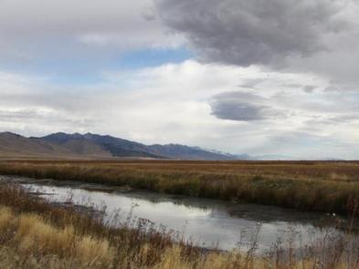
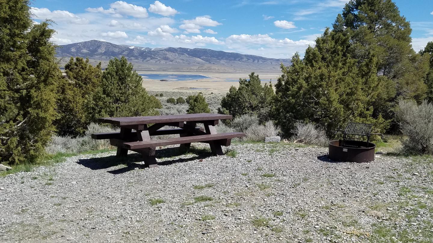
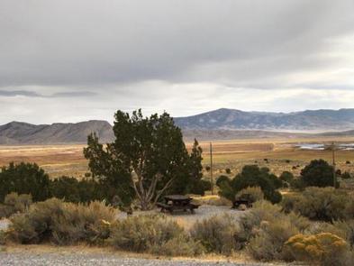
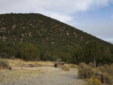
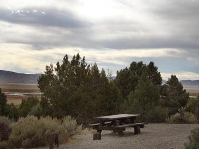
South Ruby Campground is situated above Ruby Lake at the base of the beautiful Ruby Mountains at 6,000 feet in elevation, near the Ruby Lake National Wildlife Refuge in Ruby Valley, Nevada. Ruby Valley is a surprising wildlife oasis. An expansive marsh is laced with riparian corridors coursing with cool, spring-fed waters. Together with lush meadow and shrub-steppe uplands, these habitats support a diversity of wildlife seldom found in the high desert and is one of the most important waterfowl nesting areas in the region. The refuge is either home or a stopover location for over 220 species of birds. Of specific interest are canvasback ducks, trumpeter swans, greater sandhill cranes and sage grouse. Mule deer and pronghorn antelope can also be found in the area.
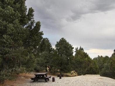
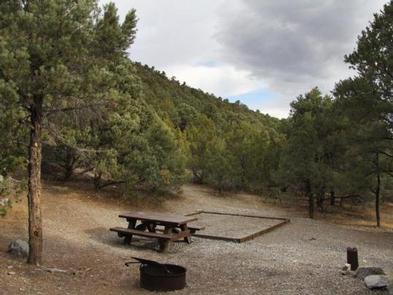
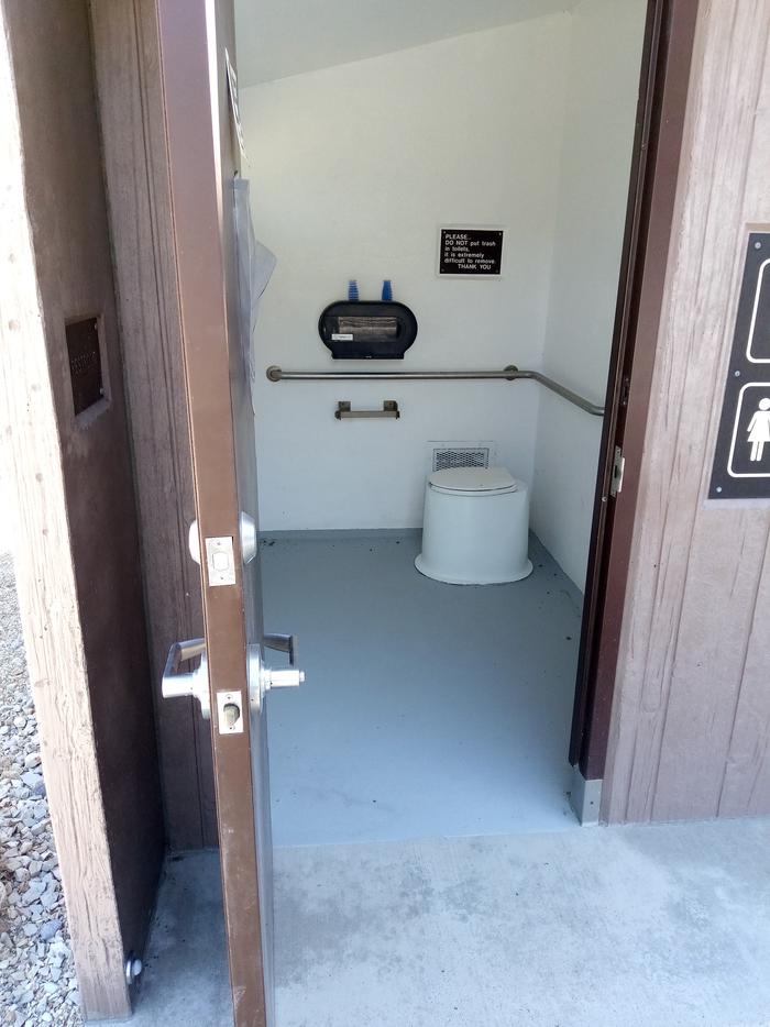
A forest of pinyon pine and juniper covers the area offering partial shade. The campground contains 33 single sites, one double and one accessible site with picnic tables and campfire rings. Vault toilets and drinking water are provided during the main summer season, which usually runs from early May to late September. Garbage service is available through the summer months. The lower loop of the campground typically remains open all winter, but may be closed depending on local conditions.
Please call the local office for further information.
Off season camping is first come first serve with a reduced fee without water available; only campsites, picnic tables, fire rings and vault toilets offered at that time. Both RV and tent campsites are available for those who visit the campground. Please call the local office for more information.
Need to Know
Natural Features
The campground is situated above Ruby Lake, at an elevation of 6,000 feet. A forest of pinyon pine and juniper covers the area. The trees provide good privacy between campsites, but limited shade.
Recreation
Ruby Lake is visible from the campground and offers excellent birding, fishing and hiking. The lake is stocked with largemouth bass and several species of trout. The Ruby Lake NWR headquarters is two miles north of the campground and offers visitor information.
The campground is located on the Hastings Cutoff route, near the Pony Express Trail and historic ruins of Fort Ruby. An interpretive trail was recently constructed at Fort Ruby historic site and provides insight on local history as well as spectacular views of the southern Ruby Mountains, uninterrupted by development. The southern trailhead for the Ruby Crest National Recreation Trail at Green Mountain Traihead is located within reasonable driving distance from the campground. Many dirt and gravel roads begin at Harrison Pass (just north of the refuge), and Overland Pass (south of the area), and provide enjoyable routes for jeeps, off-road motorcycles, OHVs, and mountain bikes.
Contact Information
Mailing
P.O. Box 246 WELLS NV 89835
Phone Number
For campground inquiries, please call: 775-752-3357
Rental Options
Learn more about gear rental options for your trip
Driving Directions
Take Interstate 80 to Highway 93. Exit at Wells and follow Highway 93 south for 30 miles to State Route 229. Follow State Route 229 for 15 miles, then head south on State Route 767 and County Road 788 for 30 miles, to the campground.
Available Campsites
- Site 029, Loop UPPE, Type Standard Nonelectric
- Site 021, Loop UPPE, Type Standard Nonelectric
- Site 024, Loop UPPE, Type Standard Nonelectric
- Site 026, Loop UPPE, Type Standard Nonelectric
- Site 018, Loop UPPE, Type Standard Nonelectric
- Site 001, Loop LOWE, Type Standard Nonelectric
- Site 009, Loop LOWE, Type Rv Nonelectric
- Site 013, Loop UPPE, Type Rv Nonelectric
- Site 010, Loop LOWE, Type Rv Nonelectric
- Site 019, Loop UPPE, Type Standard Nonelectric
- Site 020, Loop UPPE, Type Rv Nonelectric
- Site 014, Loop UPPE, Type Rv Nonelectric
- Site 022, Loop UPPE, Type Standard Nonelectric
- Site 008, Loop LOWE, Type Rv Nonelectric
- Site 034, Loop UPPE, Type Standard Nonelectric
- Site 002, Loop LOWE, Type Standard Nonelectric
- Site 033, Loop UPPE, Type Standard Nonelectric
- Site 027, Loop UPPE, Type Standard Nonelectric
- Site 005, Loop LOWE, Type Rv Nonelectric
- Site 028, Loop UPPE, Type Rv Nonelectric
- Site 016, Loop UPPE, Type Rv Nonelectric
- Site 015, Loop UPPE, Type Rv Nonelectric
- Site 023, Loop UPPE, Type Standard Nonelectric
- Site 007, Loop LOWE, Type Rv Nonelectric
- Site 003, Loop LOWE, Type Rv Nonelectric
- Site 006, Loop LOWE, Type Standard Nonelectric
- Site 031, Loop UPPE, Type Rv Nonelectric
- Site 017, Loop UPPE, Type Standard Nonelectric
- Site 004, Loop LOWE, Type Rv Nonelectric
- Site 035, Loop UPPE, Type Standard Nonelectric
- Site 011, Loop LOWE, Type Rv Nonelectric
- Site 012, Loop LOWE, Type Rv Nonelectric
- Site 025, Loop UPPE, Type Rv Nonelectric
- Site 032, Loop UPPE, Type Rv Nonelectric
- Site 030, Loop UPPE, Type Rv Nonelectric
Photo Gallery