Iron Mine
Ashley National Forest
Iron Mine Campground in nestled in the scenic North Fork Drainage off Highway 35, about 18 miles from Tabiona, Utah.
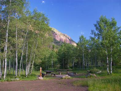
The North Fork Drainage lies on the southern slope of the beautiful Uinta Mountains in northeastern Utah. Visitors enjoy fly-fishing and exploring many local trails.
The campground contains single and double sites, and one group site that can accommodate up to 50 people.
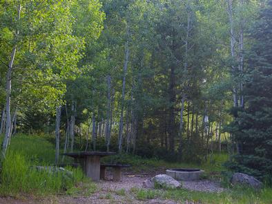
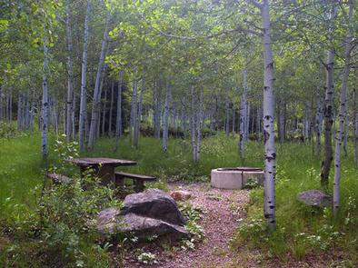
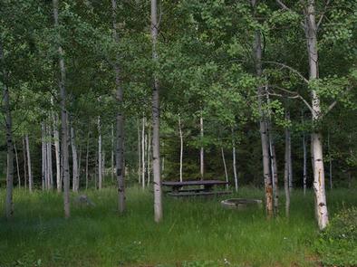
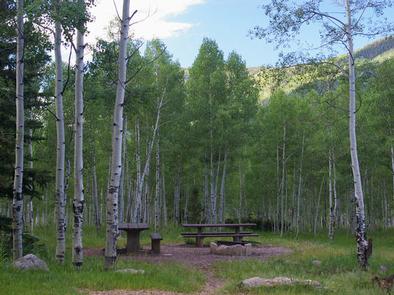
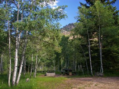
Sites are equipped with picnic tables and campfire rings. Vault toilets, drinking water and trash collection are provided. Roads and parking spurs are dirt.
Notifications and Alerts
Need to Know
- Single sites are allowed 8 people, 1 vehicle, 1 RV/trailer and 1 tent; Double sites are allowed 16 people, 2 vehicles, 2 RV/trailers and 2 tents; Group sites are allowed 32 people, 4 vehicles, 4 RV/trailers and 3 tents
- Click here for more information on the Ashley National Forest
- Don't Move Firewood: Help prevent the spread of tree-killing pests in our national forests by obtaining firewood near your destination and burning it on-site. For more information visit dontmovefirewood.org.
Natural Features
The campground is situated in an aspen forest dotted with subalpine fir, lodgepole pine and spruce near the North Fork Duchesne River at an elevation of 7,400 feet. The campground affords beautiful scenic views of the surrounding canyon and summer wildflowers are plentiful.
Nearby Attractions
The North Fork Drainage provides access to the Granddaddy Lake region of the High Uintas via Grandview Trail. Numerous sparkling lakes provide great backcountry fishing. Backpacking, hiking and horseback riding are very popular in this breathtaking area.
Recreation
Fishing for brook, brown and rainbow trout is a popular activity on the North Fork Duchesne. Hiking, mountain biking, OHV and horseback riding trails are in the area.
Changes & Cancellations
A $10.00 service fee will apply if you change or cancel your reservation. Late cancellations are subject to additional fees. For full details see NRRS Reservation Policy.
Contact Information
Default
PO BOX 981 DUCHESNE UT 84021
Rental Options
Learn more about gear rental options for your trip
Driving Directions
From Duchesne, Utah: Take Highway 87 north to the junction with Highway 35. Turn west on Highway 35 towards Tabiona and continue approximately 28 miles to the campground in the North Fork Drainage.
From Highway 40, turn north on Highway 208 to Tabiona, then proceed northwest through Hanna to the North Fork Drainage.
Available Campsites
- Site 002, Loop IRON MINE , Type Standard Nonelectric
- Site 007, Loop IRON MINE , Type Standard Nonelectric
- Site 026, Loop IRON MINE , Type Group Standard Nonelectric
- Site 006, Loop IRON MINE , Type Standard Nonelectric
- Site 014, Loop IRON MINE , Type Standard Nonelectric
- Site 009, Loop IRON MINE , Type Standard Nonelectric
- Site 003, Loop IRON MINE , Type Standard Nonelectric
- Site 001, Loop IRON MINE , Type Standard Nonelectric
- Site 008, Loop IRON MINE , Type Standard Nonelectric
- Site 012, Loop IRON MINE , Type Standard Nonelectric
- Site 005, Loop IRON MINE , Type Standard Nonelectric
- Site 010, Loop IRON MINE , Type Standard Nonelectric
- Site 011, Loop IRON MINE , Type Standard Nonelectric
- Site 004, Loop IRON MINE , Type Standard Nonelectric
- Site 015, Loop IRON MINE , Type Standard Nonelectric
- Site 013, Loop IRON MINE , Type Standard Nonelectric
Photo Gallery