Sand Flats Recreation Area
Bureau of Land Management, Utah.
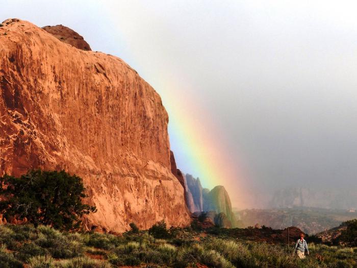
The Sand Flats Recreation Area (SFRA) near Moab, Utah is a nationally significant public lands treasure at the heart of the Colorado Plateau. A high plain of slickrock domes, bowls and fins, it rises in the east to meet the colorful mesas and nearly 13,000 foot peaks of the La Sal Mountains.
Bordering the area on the north and south are the canyons of the Grandstaff and Mill Creek Canyon Wilderness Study Areas. Further north lies the deep gorge of the Colorado River and Arches National Park. Sand Flats famous Slickrock and Porcupine Rim bike trails and almost 30 miles of jeep trails are world-renowned for their combination of challenge and awesome scenery.
Sand Flats is popular for camping and has 140 first come, first serve campsites and six group campsites. The group campsites can be reserved through Recreation.gov. Over 250,000 visitors enjoy this 9,000-acre recreation area annually. The Sand Flats Recreation Area is managed through a unique partnership between Grand County and the Bureau of Land Management. In 1995 this area was developed through the collaborative efforts of Americorps, the Bureau of Land Management, Grand County and the Moab community.
Sand Flats' mission is to protect the natural features of the area from adverse recreational impacts while providing access to sustainable and enjoyable recreational opportunities.
Passes and Fees
Sand Flats offers a few different types of passes.
- Private Vehicle - 7 Day Pass $10.00
- Bicycle or Motorcycle - 7 Day Pass $5.00
- Annual Pass - $25.00 (admits the card-holder and passengers in a single, private vehicle for day use)
- Camping: six group campsites are available for reservation on Recreation.gov. All other camping is first-come, first-serve at $15.00 per night per vehicle.
National Parks and Federal Recreational Lands, and Utah State Parks passes are not valid for entry, with the exception of the Federal Recreational Lands Access Pass.
For more information visit the Grand County Sand Flats Recreation website.
Camping and Day Use
Nearby Activities
- Auto Touring
- Biking
- Camping
- Hiking
- Off Highway Vehicle
- Picnicking
- Recreational Vehicles
Directions
Directions can be found on the Grand County Sand Flats Recreation Area website.

