Lake Sharpe

.

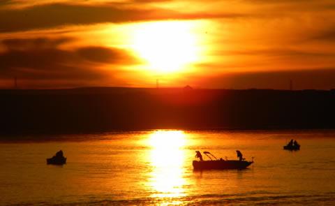
Big Bend Dam, SD takes its name from the unique bend in the Missouri River 7 miles upstream from the dam. At this point in its course, the Missouri makes almost a complete loop, traveling 25 miles before returning to the "neck" where the land is not quite a mile wide. The 19 Lake Sharpe recreation areas vary from primitive to highly developed and provide opportunities for camping, boating, picnicking, and fishing.

Camping and Day Use

  • Left Tailrace

Nearby Activities

  • Boating
  • Camping
  • Environmental Education
  • Fishing
  • Historic & Cultural Site
  • Picnicking
  • Playground Park Specialized Sport Site
  • Water Sports
  • Wildlife Viewing

Directions

From Sioux Falls, west on I-90 to Reliance, then north on SD 47.

Additional Information

  • Lake Sharpe Website
  • Lake Sharpe Photo Album

Photo Gallery

  • sunset over lake with three boatssunset over lake

Camp, RV, and Explore Outdoors

Login

Sign Up

Recreation.gov is your gateway to explore America's outdoor and cultural destinations in your zip code and across the country. We provide tools and tips to discover new adventures through a one-stop shop for inspiration and ideation, trip planning, information sharing, and reservations. Find incredible places and experiences that help you bring home a story through Recreation.gov!

Get to Know Us

  • About Us
  • Rules & Reservation Policies
  • Accessibility
  • Media Center
  • Site Map

Plan with Us

  • Find Trip Inspiration
  • Build a Trip
  • Buy a Pass
  • Enter a Lottery
  • Checkout our Mobile App
  • Rent Gear

Join Us

  • Get Involved
  • Use Our Data
  • Add Your Facility

Let Us Help You

  • Contact Us
  • Help Center
  • Submit Feedback
  • Responsible Disclosure